
CW3E AR Update: 24 January 2024 Outlook
January 24, 2024
Click here for a pdf of this information.
Active Weather Forecast to Continue into Early February for US West Coast
- An active weather pattern for the US West Coast is forecast to continue through Tue 30 Jan and potentially beyond.
- The first AR period begins early Fri 26 Jan as an AR makes landfall into the PNW. This AR kicks off a period of AR conditions in the PNW and Northern California expected to continue through Tue 30 Jan.
- The second AR is forecast to make landfall early Sun 28 Jan into the PNW, continuing AR conditions in the region.
- The third, strongest AR is forecast to make landfall into British Columbia and the PNW toward the end of this AR period on Tue 30 Jan.
- All three ARs are forecast to bring precipitation to the USWC, with the heaviest rainfall expected from the first and second ARs over CA/OR border and into the PNW with the third AR.
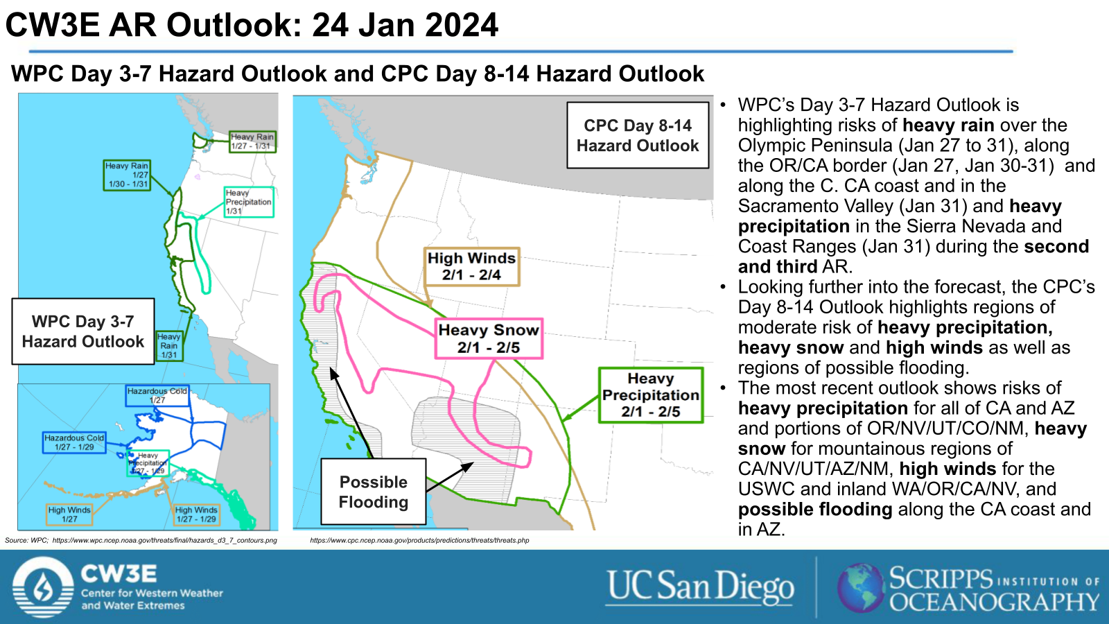
- The WPC Excessive Rainfall Outlook indicates a Marginal Risk (level 1 of 4, or at least 5% chance) for flooding in days 3 through 5 (24-hour periods ending 4 AM PT Sat 27 Jan, Sun 28 Jan and Mon 29 Jan) along the PNW coast and over the Olympic Peninsula.
- The third AR is forecast to progress down the USWC and potentially bring impacts to much of the Western US. The Climate Prediction Center (CPC) has already indicated a moderate risk for heavy precipitation, heavy snow, and high winds for regions in the Western US and possible flooding along the CA coast and in AZ for Jan 31 through Feb 5.
Click images to see loops of GFS IVT and IWV forecasts Valid 1200 UTC 24 January 2024 – 0000 UTC 1 February 2024 |
|
 |
 |


Summary provided by M. Steen, C. Castellano, S. Bartlett, S. Roj and P. Iniguez; 24 January 2024
To sign up for email alerts when CW3E post new AR updates click here.
*Outlook products are considered experimental