
CW3E AR Update: 16 November 2020 Outlook
November 16, 2020
Click here for a pdf of this information.
Active pattern is forecast to continue as another atmospheric river makes landfall this evening
- Multiple landfalling ARs have produced heavy rainfall and snowfall across the northwestern U.S. and Northern California over the past several days
- A cyclone and an associated AR currently located over the Eastern Pacific are forecast to strengthen as they propagate towards the Pacific Northwest and southern British Columbia
- Current forecasts suggest that this AR may bring AR 3–4 conditions (based on the Ralph et al. 2019 AR Scale) to the Pacific Northwest and AR 1–2 conditions to Northern CA
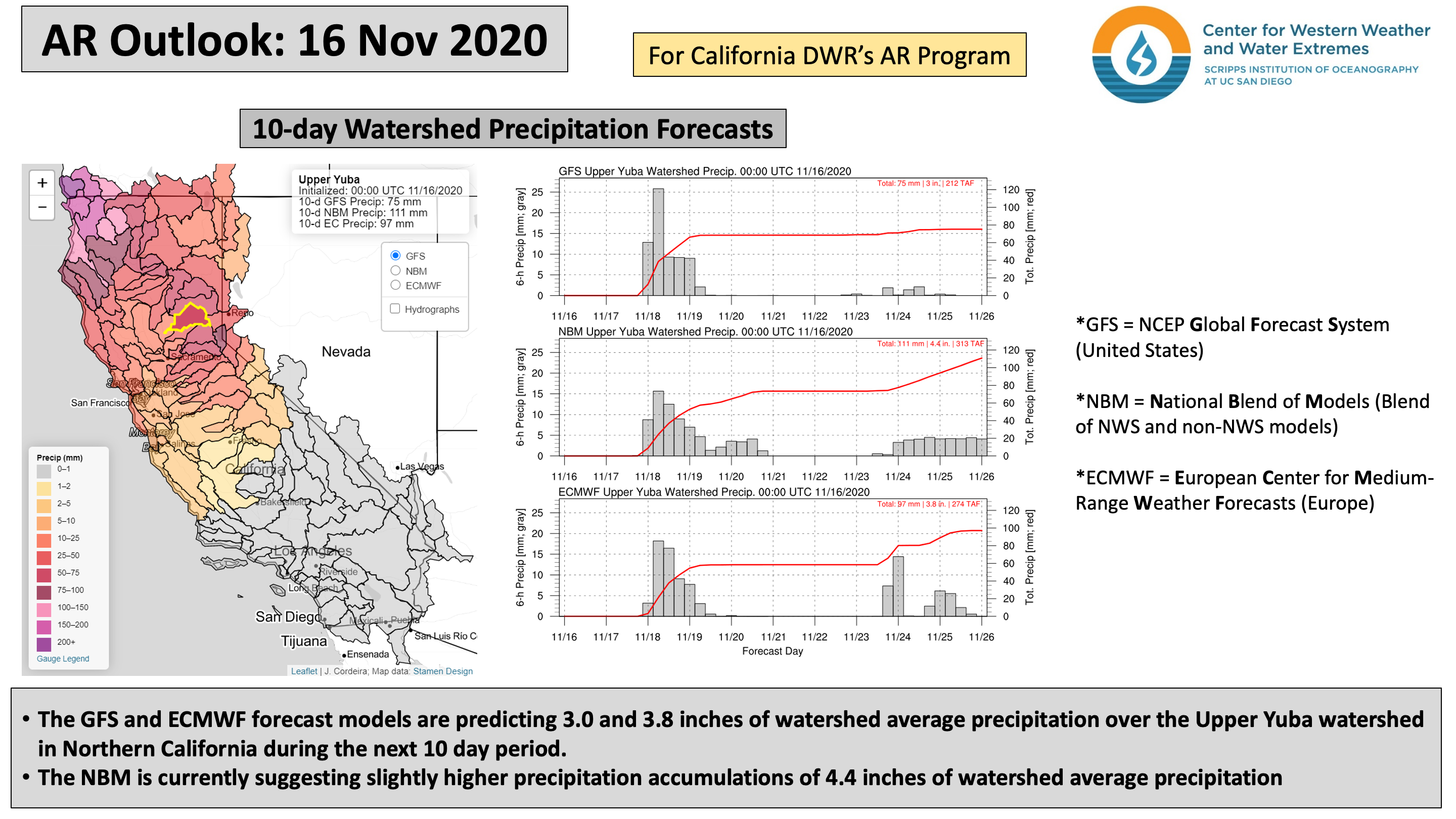
- The WPC is forecasting as much as 3.5 inches of precipitation across numerous coastal and high elevation locations across the PNW and Northern CA
- High wind speeds are forecast to impact coastal locations and high elevations from WA to Northern CA
Click images to see loops of GFS IVT/IWV analyses and forecasts Valid 1200 UTC 16 November – 1200 UTC 26 November 2020 |
|
 |
 |


Summary provided by C. Castellano, C. Hecht, J. Kalansky, B. Kawzunek, and F. M. Ralph; 16 November 2020
*Outlook products are considered experimental