
CW3E AR Update: 14 October 2020 Event Summary & Outlook
October 14, 2020
Click here for a pdf of this information.
Active weather pattern to continue across the Pacific Northwest
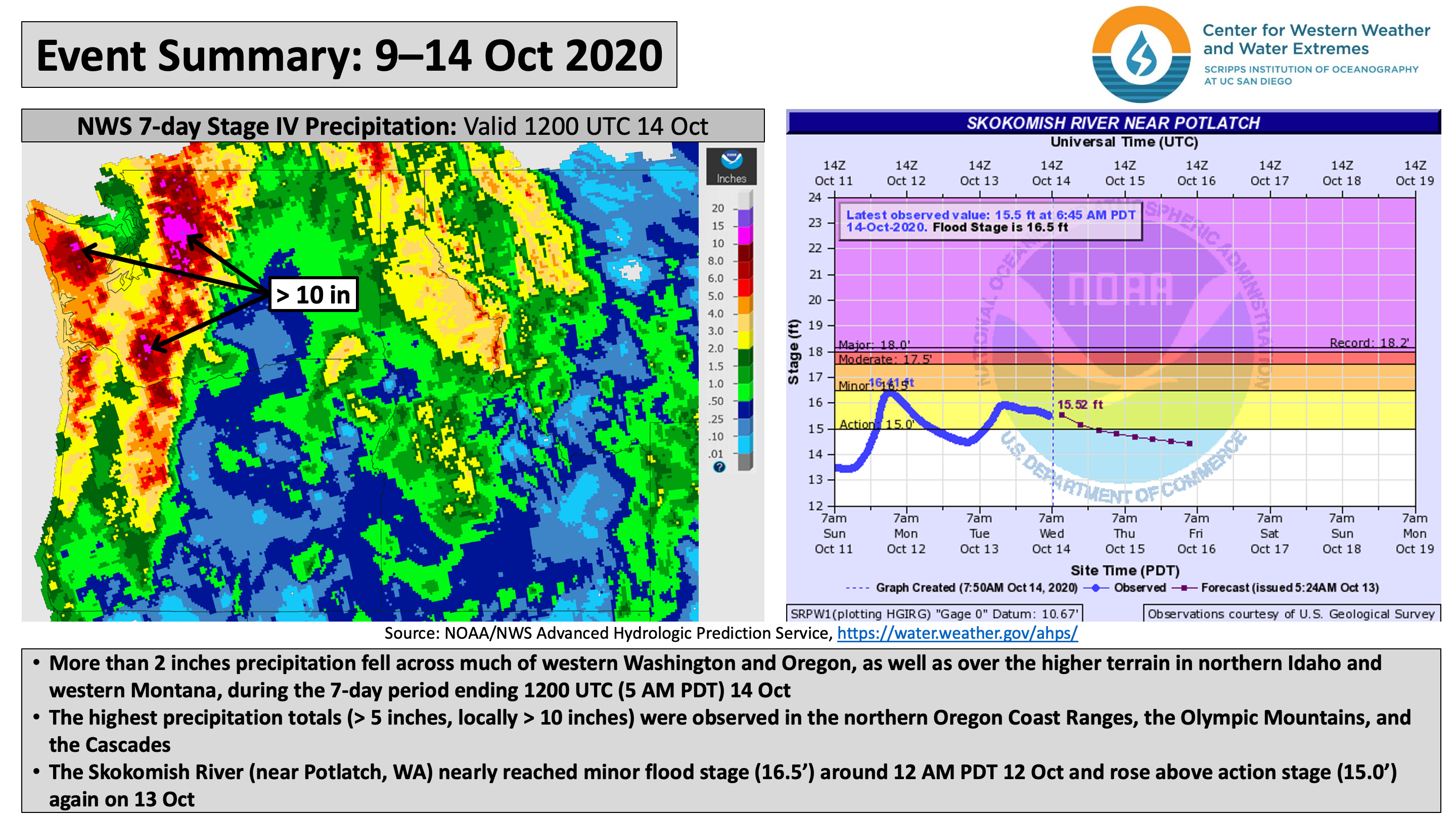
- A series of landfalling ARs resulted in heavy rainfall and snowfall across the Northwestern US between 9 Oct and 14 Oct
- The ongoing AR is expected to produce AR 4/AR 5 conditions (based on the Ralph et al. 2019 AR Scale) along the coast of Washington and Oregon
- Total estimated 7-day precipitation ending 14 Oct exceeded 5 inches over the northern Oregon Coast Ranges, Olympic Mountains, and Cascades, with some locations receiving more than 10 inches
- Significant snowfall also occurred over portions of the Washington Cascades and Rocky Mountains in Idaho and Montana
- Additional AR activity and precipitation are forecast across the Pacific Northwest during the next several days
Click images to see loops of GFS IVT/IWV analyses and forecasts Valid 1200 UTC 14 October – 1200 UTC 24 October 2020 |
|
 |
 |


Summary provided by C. Castellano, C. Hecht, J. Kalansky, N. Oakley, and F. M. Ralph; 14 October 2020
*Outlook products are considered experimental