
CW3E AR Update: 13 October 2023 Outlook
October 13, 2023
Click here for a pdf of this information.
Multiple Atmospheric Rivers Forecast to Impact Pacific Northwest Through the Weekend
- A series of atmospheric rivers (ARs) are forecast to make landfall over the Pacific Northwest during the next few days
- The first and second ARs are forecast to bring weak AR conditions (IVT < 500 kg m−1 s−1) to coastal Washington, Oregon, and Northern California today and Saturday
- The third and strongest AR is forecast to make landfall Sunday into Monday
- An AR4/AR5 is possible in coastal OR due to IVT magnitudes potentially exceeding 1000 kg m−1 s−1 and AR conditions potentially lasting more than 48 consecutive hours between the second and third ARs
- There is still considerable forecast uncertainty in the intensity of the third landfalling AR
- The ECMWF Ensemble Prediction System (EPS) continues to forecast higher IVT magnitudes in coastal OR and WA compared to the NCEP Global Ensemble Forecast System (GEFS)
- The NWS Weather Prediction Center (WPC) is forecasting at 2–5 inches of precipitation in the Olympic Mountains and North Cascades during the next 5 days
- Models are still showing some disagreement in forecast precipitation, with the ECMWF/EPS models predicting higher precipitation amounts in the Olympic Peninsula compared to the GFS/GEFS models
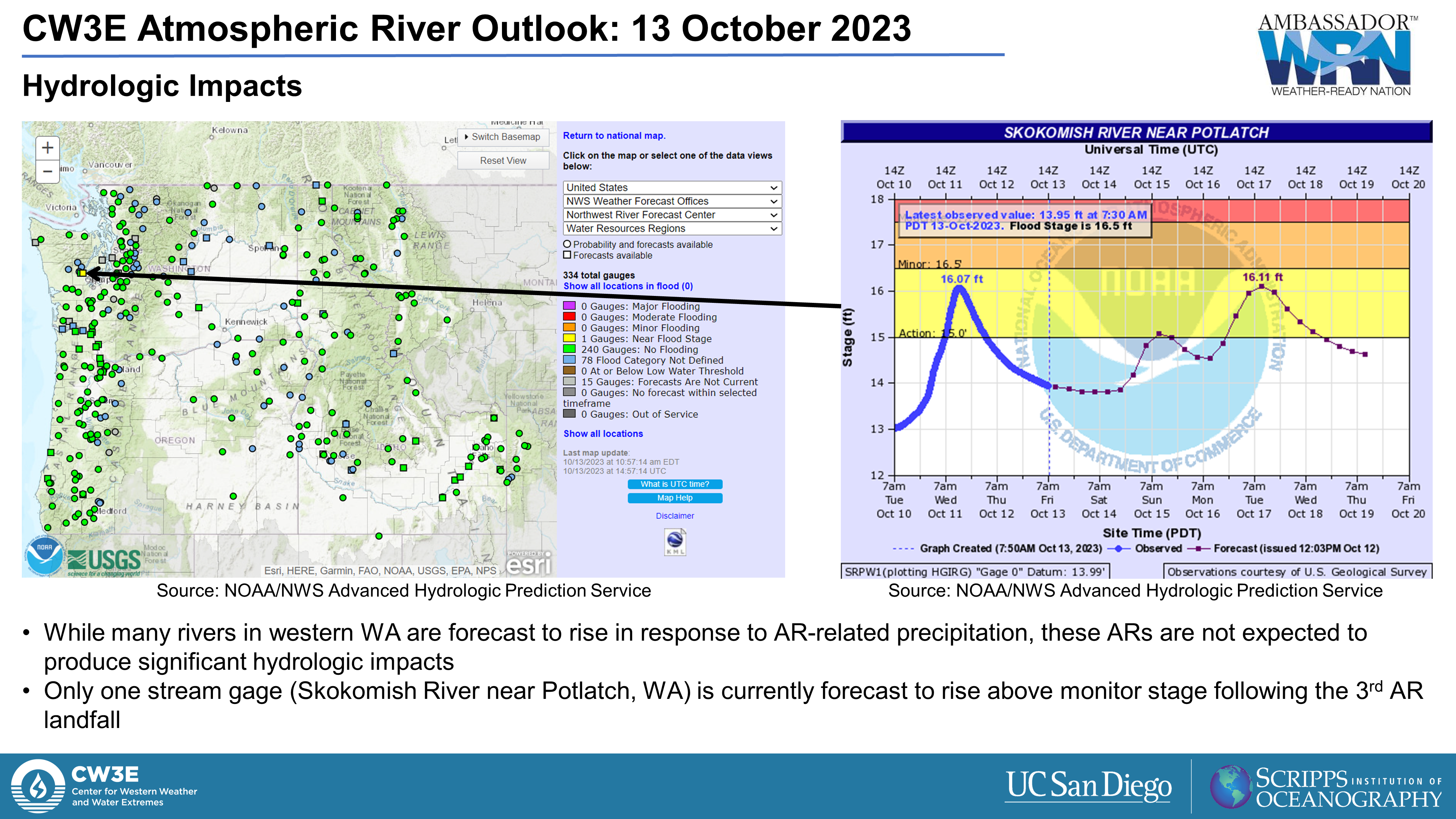
- Despite the high likelihood of strong AR conditions (IVT > 750 kg m−1 s−1) during the third AR, the south-southwesterly orientation of moisture transport will be unfavorable for orographic enhancement of precipitation in most areas, and significant hydrologic impacts are not anticipated
Click images to see loops of GFS IVT and IWV forecasts Valid 1200 UTC 13 October – 1200 UTC 20 October 2023 |
|
 |
 |


Summary provided by C. Castellano, S. Bartlett, P. Iniguez, J. Kalansky, and S. Roj; 13 October 2023
To sign up for email alerts when CW3E post new AR updates click here.
*Outlook products are considered experimental